Earth: Series 1, Inferno - Understanding Geological Processes

Table of Contents
Plate Tectonics: The Driving Force Behind Geological Activity
Plate tectonics is the cornerstone of understanding most geological activity. This theory proposes that Earth's lithosphere – the rigid outer shell – is fragmented into several large and small plates that are constantly moving, albeit slowly, atop the semi-molten asthenosphere. This movement is the driving force behind earthquakes, volcanic eruptions, mountain building, and the creation of ocean basins. Understanding plate tectonics is crucial for comprehending the vast array of geological processes.
Types of Plate Boundaries:
- Divergent boundaries: Plates move apart, creating new crust. A prime example is the Mid-Atlantic Ridge, where seafloor spreading pushes the North American and Eurasian plates away from each other. This process contributes to the continuous expansion of the Atlantic Ocean.
- Convergent boundaries: Plates collide. Subduction zones form when one plate slides beneath another (e.g., the Nazca Plate subducting under the South American Plate, forming the Andes Mountains). When two continental plates collide, immense mountain ranges like the Himalayas are formed.
- Transform boundaries: Plates slide past each other horizontally. The San Andreas Fault in California is a classic example, where the Pacific Plate grinds past the North American Plate, resulting in frequent earthquakes.
Evidence Supporting Plate Tectonics:
-
Fossil distribution: Similar fossils found on widely separated continents suggest they were once joined.
-
Seafloor spreading: New oceanic crust is formed at mid-ocean ridges, providing evidence for plate separation.
-
Continental drift: The continents' apparent movement over geological time scales supports the theory of plate tectonics.
-
Magnetic stripes on the ocean floor: Alternating magnetic polarities in the seafloor rock record changes in Earth's magnetic field over time, providing evidence for seafloor spreading.
-
Key Features Summary:
- Divergent: Seafloor spreading, mid-ocean ridges, volcanic activity.
- Convergent: Subduction zones, mountain building, volcanic arcs, earthquakes.
- Transform: Earthquakes, fault lines, lateral movement.
Volcanism: The Fiery Heart of Our Planet
Volcanism, the eruption of molten rock (magma) onto the Earth's surface, is a spectacular manifestation of geological processes. Different types of volcanoes exist, each with its own characteristic shape and eruption style:
- Shield volcanoes: Broad, gently sloping volcanoes formed by effusive eruptions of low-viscosity lava (e.g., Mauna Loa in Hawaii).
- Composite volcanoes (stratovolcanoes): Steep-sided volcanoes formed by alternating layers of lava and pyroclastic material (e.g., Mount Fuji in Japan).
- Cinder cone volcanoes: Small, cone-shaped volcanoes formed by explosive eruptions of ash and cinders (e.g., Paricutin in Mexico).
Volcanic Eruptions and their Impacts:
Volcanic eruptions are triggered by the build-up of pressure from magma and gases within the Earth's crust. Eruptions can be explosive (highly viscous magma) or effusive (low-viscosity magma).
-
Short-term impacts: Loss of life, destruction of property, disruption of air travel, ash fall.
-
Long-term impacts: Soil enrichment (volcanic ash is rich in nutrients), creation of new landforms, climate change (due to large-scale eruptions).
-
Famous Volcanoes:
- Mount Vesuvius (Italy): Famous for its destructive eruption that buried Pompeii.
- Mount St. Helens (USA): Known for its devastating 1980 eruption.
- Krakatoa (Indonesia): Its 1883 eruption caused a global climate change.
Understanding Magma Formation and Composition:
Magma forms through the melting of rocks within the Earth's mantle and crust. The composition of magma, particularly its silica content, determines its viscosity and eruptive style. High silica magma is more viscous and leads to explosive eruptions, while low silica magma is less viscous and results in effusive eruptions. The resulting rock types also vary widely depending on the magma composition.
Earthquakes: The Shaking Ground
Earthquakes are sudden releases of energy in the Earth's crust, typically caused by the movement of tectonic plates along fault lines. The energy is released as seismic waves that cause the ground to shake.
Measuring Earthquakes:
The Richter scale and moment magnitude scale are used to measure the magnitude of earthquakes. The moment magnitude scale is preferred for larger earthquakes as it provides a more accurate measure of the energy released.
Earthquake Hazards and Mitigation:
Earthquakes cause significant hazards, including:
- Ground shaking: The primary cause of damage to buildings and infrastructure.
- Tsunamis: Large waves generated by undersea earthquakes.
- Landslides: Ground instability triggered by shaking.
Mitigation strategies include:
-
Building codes designed to withstand seismic activity.
-
Early warning systems to give people time to evacuate or take cover.
-
Public education programs to increase awareness and preparedness.
-
Significant Earthquakes:
- 1906 San Francisco Earthquake: Caused widespread destruction.
- 2011 Tohoku Earthquake and Tsunami: Triggered a devastating tsunami in Japan.
- 2010 Haiti Earthquake: A highly destructive earthquake in a densely populated area.
Weathering and Erosion: Shaping the Landscape
Weathering and erosion are geological processes that constantly reshape the Earth's surface. Weathering breaks down rocks and minerals, while erosion transports the weathered material.
- Physical weathering: The mechanical breakdown of rocks (e.g., freeze-thaw cycles, abrasion).
- Chemical weathering: The chemical alteration of rocks (e.g., dissolution, oxidation).
Agents of Erosion:
- Wind: Transports sediment, creating features like sand dunes.
- Water: Rivers, streams, and ocean currents erode and transport sediment.
- Ice (glaciers): Powerful agents of erosion, carving valleys and transporting vast amounts of sediment.
- Gravity: Causes mass wasting events like landslides and rockfalls.
Landforms Created by Weathering and Erosion:
-
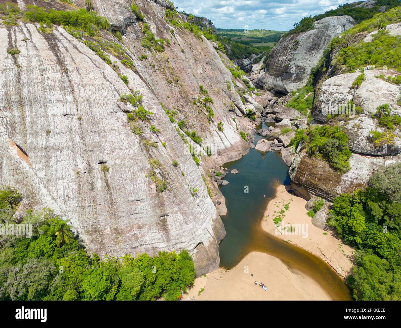
Canyons: Deep valleys carved by rivers.
-
Beaches: Accumulations of sediment deposited by waves.
-
Caves: Formed by the dissolution of soluble rocks.
-
Examples of Landforms:
- The Grand Canyon (USA): Carved by the Colorado River.
- The fjords of Norway: Formed by glacial erosion.
- The karst landscapes of China: Characterized by caves and sinkholes.
Conclusion
Understanding geological processes—plate tectonics, volcanism, earthquakes, and weathering/erosion—is essential for comprehending the dynamic nature of our planet. These processes are interconnected and have shaped the Earth's surface over millions of years. Understanding these processes is crucial for hazard mitigation, resource management, and appreciating the dynamic beauty of our planet. Deepen your understanding of geological processes by exploring further resources from organizations like the USGS (United States Geological Survey) and National Geographic. Continue your journey into the science of geological processes – the Earth's story is waiting to be discovered!

Featured Posts
-
 Herthas Woes Boateng And Kruse Offer Contrasting Perspectives
May 13, 2025
 -
 Championship Play Offs A Newcastle United Fan Perspective
May 13, 2025
 -
 The Impact Of Walleye Credit Cuts On Commodities Teams And Core Client Groups
May 13, 2025
 -
 Jaringan Penipuan Online Internasional Foto Foto Korban Di Myanmar Ada Warga Negara Indonesia
May 13, 2025
 -
 Who Is Angela Swartz A Profile
May 13, 2025
